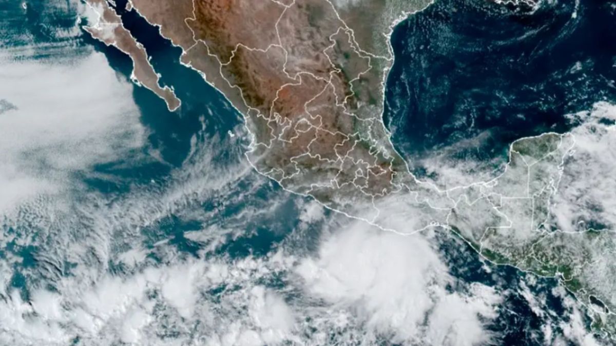
Tropical storm Beatriz, the second cyclone of the 2023 season, formed this Thursday in the Mexican Pacific, and its cloud bands will cause rain in western, central, southern and southeastern states of Mexico, reported the National Meteorological Service (SMN) of Mexico .
In a statement, the SMN indicated that tropical depression “2-E” intensified into tropical storm “Beatriz”, its cloudy bands will cause very heavy to occasional torrential rains in the aforementioned regions of the country.
“The rains will be accompanied by electric shocks and possible hail, and could cause an increase in the levels of rivers and streams, landslides, and flooding in low-lying areas. Also, strong gusts of wind and high waves are expected on the coasts of Guerrero and Oaxaca,” said the SMN.
In the report, the SMN indicated that the phenomenon is located 170 kilometers south-southwest of Punta Maldonado, Guerrero, and 220 km south-southeast of Acapulco, Guerrero.
In addition, it presents maximum sustained winds of 65 kilometers per hour (km/h), gusts of 85 km/h and displacement towards the west-northwest at 19 km/h.
In its forecasts, the Meteorológico de México pointed out that on Friday, around noon, the storm will intensify to a category 1 hurricane when it is located 85 km south-southwest of Lázaro Cárdenas, Michoacán, and 105 km west-southwest of Zihuatanejo , Warrior.
In its forecasts, the SMN said that “intense to torrential occasional rains (150 to 250 millimeters (mm)) will originate in Oaxaca and Guerrero; punctual intense rains (75 to 150 mm) in Jalisco, Colima, Michoacán, Chiapas and Veracruz; Very strong punctual rains (50 to 75 mm) in the State of Mexico and Tabasco.
Rains could cause flooding and landslides
“Very heavy to torrential rains could cause an increase in the levels of rivers and streams, landslides and flooding in low-lying areas,” the agency said.
Winds with gusts of 60 to 80 km/h and waves of 2 to 4 meters high are also expected on the coasts of Oaxaca and Guerrero.
Given these conditions, the SMN asked the population of these states to take extreme precautions against rain, wind and waves (including maritime navigation) and to comply with the recommendations issued by the authorities of the National Civil Protection System, in each entity.
In early May, the Government of Mexico forecast the possible formation of up to 38 named cyclones in the 2023 season, of which 5 could impact the country.
Of that number, between 16 and 22 systems could occur in the Pacific Ocean and between 10 and 16 in the Atlantic.
The SMN pointed out that in the case of the Pacific “16 to 22 tropical cyclones are expected, including 9 to 11 tropical storms, 4 to 6 category 1 and 2 hurricanes, and 3 to 5 category 3, 4 and 5”.
The Government of Mexico said in a conference that “the system has a trajectory parallel to the coast and, according to the most recent forecast, it could make landfall on Saturday between Colima and Jalisco.
In 2022, 36 tropical cyclones were generated in Mexico, 19 in the Pacific and 17 in the Atlantic, and of these systems, 10 affected the country, 8 impacted, and the bands of the other 2 caused considerable flooding and rain.
Keep reading:
· Global crisis: The countries most vulnerable to climate change
The duo of storms Cindy and Bret in the Atlantic have not been seen in decades
The duo of storms Cindy and Bret in the Atlantic have not been seen in decades
