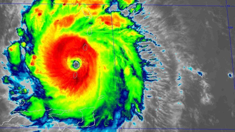
A historic cyclone. Beryl became a “potentially catastrophic” Category 5 hurricane hours after making landfall on the island of Carriacou, part of the Grenada archipelago, and as it continues its advance through the Caribbean.
This was reported by the US National Hurricane Center (NHC), which also reported maximum sustained winds of 257 km/h.
Forecasts indicate that it could affect Jamaica and the south of Hispaniola, the island made up of the Dominican Republic and Haiti, in the coming days.
Beryl has surprised scientists by becoming the most powerful hurricane to form so early in that area of the Atlantic.
In the Windward Islands, it produced catastrophic winds and storm surge, the NHC reported.
“Within half an hour, Carriacou was flattened,” Grenada Prime Minister Dickon Mitchell said on Monday.

In a post on X before the hurricane was upgraded to Category 5, University of Miami meteorology professor Brian McNoldy stated that “these islands have no experience with a Category 4 hurricane in recorded history.”
Following the passage of Beryl, Granada has suffered power outages that have affected communications and access to government information.
Airports and businesses were closed and residents across the Caribbean were urged to seek shelter ahead of the potentially devastating storm. Dozens of flights were cancelled across the region.


A hurricane warning was also in effect for Saint Vincent and the Grenadines, Barbados and Tobago.
“This is not a joke,” said St. Vincent and the Grenadines Prime Minister Ralph Gonsalves, recalling the devastation caused by past hurricanes in the Caribbean.
Beryl is expected to arrive in Jamaica on Wednesday.
The US National Oceanic and Atmospheric Administration (NOAA) had warned of the implications of a storm becoming a major hurricane at this time of year.
“It’s surprising to see a forecast for a major hurricane (Category 3+) in June anywhere in the Atlantic, let alone this far east in the deep tropics,” Michael Lowry, a hurricane expert, said on social media.
“There have only been five major hurricanes (Category 3+) recorded in the Atlantic before the first week of July. Beryl would be the sixth and the earliest in this end of the tropical Atlantic.”
A “very active” season

In May, NOAA announced a “very active” season for this year that could bring 17 to 25 storms large enough to be named.
Of those, at least seven are expected to be major hurricanes.
These forecasts are partly due to the high probability of the La Niña phenomenon forming during the second half of the year, following the effects of El Niño in 2023.

American researchers recently stated that there is a 60% chance of La Niña developing between June and August, and an 85% chance of this happening by autumn.
The cooling effect of La Niña may also slightly slow the rate of global warming.
This could indicate that the record temperatures experienced last year are not evidence that the world has entered a more rapid phase of warming.


Beam click here to read more stories from BBC News Mundo.
You can also follow us on Youtube, Instagram, TikTok, X, Facebook and in Our new WhatsApp channelwhere you’ll find breaking news and our best content.
And remember that you can receive notifications in our app. Download the latest version and activate them.
- The El Niño phenomenon is ending: what effects it had and what could happen with La Niña in the coming months
